How to Use GPS with Metal Detecting for Precise Location Tracking?
Can you imagine that a gadget would be the digital memory of your adventures in metal detecting?
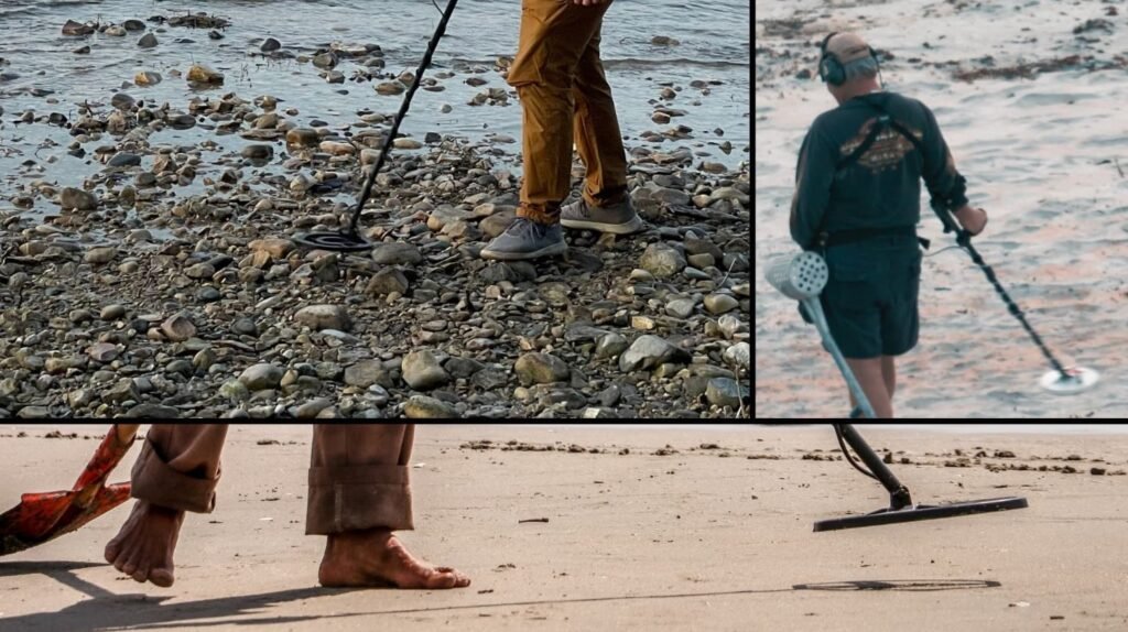
Metal detecting is not as easy a task as it may seem. Just sweeping a device on the ground in your hand is not the game, especially when you are a beginner in metal detecting. It is a mixture of patience, technology, and strategy.
If you want your Metal detecting experience to be at the next level, then you must have to include GPS in your routine to improve efficiency and accuracy.
By using this technology, you will be able to track the precise location, map the search area. Also, you can mark the locations of your findings.
First of all, you must be sure that you are using a reliable GPS device. It always depends on the type of location you are selecting, how frequently you are going there, and the accuracy you want.
Key Benefits of using GPS in Metal detecting
- Record important discoveries with exact location and depth.
- Sync data among devices or detect partners
- Track searched zones to prevent redundant scanning
- Combine your routes with old historical maps.
- Map property borders to ensure legal compliance.
The Result: a better-structured, data-driven metal detection process that can be repeated, examined, and improved over time.
How to use a GPS in Metal detecting?
Turning on GPS isn’t enough. Here’s a field-tested method for making your Metal detecting successful.
Pre-Plan about the desired Area:
Use GPS apps or software to see the topography maps or satellite imagery before you go. This way, you will be able to detect the desired location, excluding the building sites, abandoned areas, and any new changes.
To find possible relic zones, you should import the old maps and counter-check with the latest GPs data.
Mark your starting point:
Log your beginning place as a waypoint once you’re on location. This will help in case you lose the position; it gives you a reference point to go.
Grid Searching:
Use your GPS map’s waypoints or drawn lines to make a grid. For instance:
- Mark four corners of a space that is 100 by 100 feet.
- Work systematically inside the grid.
- When you get finished, move to the next one.
Track the movement:
If you want to review the track you have already visited, or want to share it with others. Then there comes a feature called the breadcrumb or track log feature that displays a route that you have walked on.
Log finds with way points:
There are some GPs programs with the facility of capturing pictures, audio and written notes.
Every time you find some valuable thing, mark this with a waypoint and give it a name. Your map will eventually become a hotspot database.
Analyze and export:
After you have done the Metal detecting, try to export the data to the desktop application or Google Earth. This enables you to identify patterns, compare hunt zones, and improve your tactics.
GPs' essential equipment required for Metal detecting
There are many available in the market, like a standalone device, and some come with smartphone apps that can coordinate your findings, site conditions, and depth. You can always access the map offline, too. Also, by digital logging, it can refine the strategies and analyze your search patterns.
1. Handheld GPS Devices:
- They are made for outdoor exploration as they are rugged, very reliable, waterproof and work without cellular services.
- Examples are Garmin eTrex 32x and GPSMAP 66.
- Features include offline functionality, waypoint marking, topo maps, and track logging.
- They are perfect for remote farms, wilderness areas, and historic sites.
2. Smartphone GPS with Apps:
- They are more updated than even if you have no internet connection, their built-in GPS can function when the maps are preloaded.
- You may utilize apps like Google Earth, Maprika, OnX Hunt, Gaia GPS, and even Google Maps.
- They are multifunctional, user-friendly, and reasonably priced.
- But it has a short battery life that may not work for long hours.
- And yes, they are excellent for beginners or in urban areas, for Metal detecting.
3. GPS Watches:
- If you want to be hands-free from extra equipment, then this would be the best choice.
- They are portable and lightweight but of course, they can’t beat the handheld devices.
- Some high-tech watches, such as the Garmin Fenix, Suunto 9, and Coros Vertix, have waypoint and GPS tracking capabilities.
- It is often used for casual hunting.
Things to consider while using GPS for Metal detecting
- Preload the maps before you go for Metal detecting with GPS, as some areas may not have cellular coverage.
- Keep with you the power bank, solar chargers, or spare batteries because devices or phones drain quickly, mainly when the GPS is being used.
- In some cases, there are tall buildings or in forests, the tall trees that cause the signal loss. For this high-end GPS is better than a phone.
Best Practices for logging and recording
Some Apps like Lucky Find and OnX Hunt allow:
- GPS monitoring.
- Find the classification type.
- Adding information and taking a picture.
- Property boundary overlays
Combine this data to identify high-yield areas and find geographical trends.
Recognizing GPS Formats and Coordinates
Understand how you will read the GPS.
Common Formats:
- Most apps use decimal degrees (DD).
- Traditional format for degrees, minutes, and seconds (DMS)
- Decimal minutes in degrees (DMM): a standard for aviation and marine
- Determining your latitude first will help you a lot (for example, 43.5890, -116.2190).
Tip: If you want to avoid mistakes, then stick to the same format throughout your journey. If it is necessary to change, then learn first how to manage them.
Keeping Your Logs in Order
Utilize cloud-based diaries or Google Sheets for your records:
- Trace the coordinates
- Permissions from landowners
- Weather conditions
- Historical allusions and map overlay.
If you have a systematic approach, then your logging system will become more than a hobby.
Smartphone Apps That Improve Your Detection
Smartphone Apps will make your Metal detecting journey easy in tracking and analyzing. You should look for:
LuckyFind:
- At each waypoint, include remarks, item kind, and images.
- Both offline and cloud-synchronized
- Excellent for planning and monitoring early discoveries
Tect O Trak:
- Using a breadcrumb trail for real-time route tracking
- Locally stored data for complete confidentiality
- Export results for Google Earth in GPX/KML
- Perfect for sole relic searchers and detectorists
GO TERRAIN (for users of XP Deus):
- Syncs to XP detectors over Bluetooth and automatically logs findings.
- Group tracking in real time (up to 6 people)
- Boundary warnings and offline maps
- Automatic depth and signal logging saves time.
OnX Hunt:
- Displays property lines along with landowner details.
- Assists you in lawfully requesting and monitoring permissions
- Provides satellite, hybrid, and topo maps.
- Ideal for organizing hunts and preventing trespassing
Mapping Software Integration & Data Export
Mapping software improves your detection experience by recording and visualizing your search areas. You can again go to the high-yield areas with this data whenever you want.
Top Mapping Resources:
- Google Earth shows the discoveries in hybrid and satellite views
- With offline layers, LOCUS Map Free is ideal for Android devices.
- QGIS is a sophisticated open-source program for overlaying ancient maps.
- GPS handhelds can be synced with BaseCamp (Garmin).
Typical Export Formats
- KML is perfect for overlays on Google Earth.
- GPX is excellent for sharing routes and waypoints.
- CSV: for statistics and spreadsheet sorting
- GPKG is a file that contains both media and detailed maps.
Pro Tip: Use ancient aerial or topographic maps to overlay historical hotspots that modern detectors may miss.
Accurate Site Records & Legal Limitations
Maintaining efficiency and legality in the field is ensured by accurate site logging.
- Defining the Boundaries of Property.
- Verify property lines with Plat Maps or OnX Hunt.
- Set waypoints at every corner marker
- If boundaries are doubtful or unclear, seek help from an expert.
Top GPS Accuracy Techniques
- For a clean satellite lock, stay in the open sky.
- Before each session, adjust the compass.
- Turn on WAAS or SBAS correction for an accuracy of ±1m.
Pro Tip: For future reference, add a note on every terrain and land.
Maintaining Digital Records and Backups
Your Metal detecting journey gets organized and recoverable by a well-managed digital log.
Smart Logging Strategies:
- Take note of the weather, time of day, and landowner permits.
- For visual indications, use voice notes or geo-tagged images.
- Keep track of the depth, composition, and kind of soil for each find.
Best Practices for Backups:
- Connect to Dropbox, OneDrive, or Google Drive.
- Store local copies on external disks or SD cards.
- For cloud security, turn on two-factor authentication.
Expert Tip: To efficiently arrange your logs and maps, use naming conventions (such as Date, Location, Type).
Frequently Asked Questions (FAQs)
Does GPS work through Metal?
No, GPS does not work through Metal effectively. GPS uses radio signals that are reflected or blocked by Metal. Signal reception may be interfered with or stopped entirely as a result.
What type of GPS device is best for Metal detecting?
The best option for Metal detecting is the handheld device that provides the best accuracy, long battery timing with the ability to store tracks and waypoints.
Do I need internet access to use GPS for Metal detecting?
No, you don’t need any internet to use GPS while metal detecting. Actually, it works on the satellite signals. However, some metal detectors and apps may have features that require online connectivity for real-time tracking or map downloads.
What are waypoints in GPS, and how are they used in Metal detecting?
A waypoint in GPS is a place that has been stored and is identified by coordinates (latitude and longitude) and is used as a navigational reference. Waypoints are used in Metal detecting to record specific locations of interest, identify discoveries, and indicate prospective regions to plan future hunts.
Recent Posts